 Goves Mountain
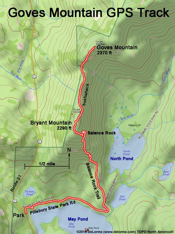
Hike to Bryant Mountain, Goves Mountain (sub-peak) and back:
2370 feet high (1100 feet up)
7 miles 5 hours (moderate)
via road, Balance Rock Trail and bushwhack
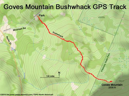
Or, bushwhack from Mountain Road:
N 43 16.608
W 72 06.949
to Goves Mountain (true summit)
Hike List: NH 201-300 Highest
There are three summits involved here:
- Bryant Mountain: 2290 feet
- Goves Mountain sub-peak: 2370 feet
- Goves Mountain true summit: 2530 feet
