 Boundary Bald Mountain
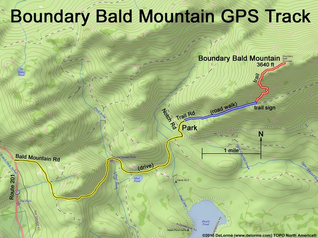
Hike to Boundary Bald Mountain and back:
3640 feet high (1700 feet up)
5 miles 4 hours (difficult)
via Trail Road and Bald Mountain Tower Trail
Hike List: New England 50 Finest
Guide: AMC Maine Mountain Guide
Website: FranklinSites
Website: MainebyFoot
Website: AllTrails
This hike is more difficult than it might
seem because the trail is intermittently
steep, wet, rough and hard to follow.
