 < back
Wunnegen
next >
< back
Wunnegen
next >
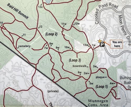
| The best trail map I have found is this one, posted at the trailhead kiosk. Most trail junctions are labeled with these numbers to help us hikers know where we are. The Wunnegen junction labels have a "w" to distinguish them from the those in the adjacent Bald Hill Reservation (in Boxford State Forest). This property is managed by BTA/BOLT (Boxford Trail Association / Boxford Open Land Trust). |