< back
Wildcat Falls
next >
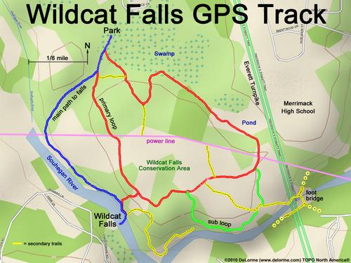
Here is a GPS-track map of Wildcat Falls Conservation Area. Blue is the easiest route to the falls, red is a major loop, green is a sub loop, pink is the power-line swath, and yellow are secondary trails.
LARGE MAP
 < back
Wildcat Falls
next >
< back
Wildcat Falls
next >