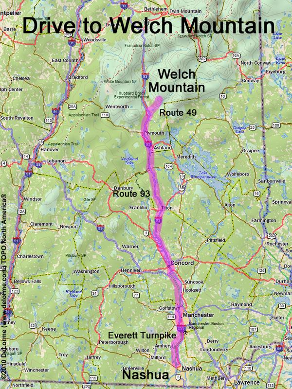
directions to Welch Mountain

Location:

Southeast of the Kancamagus Highway
Near the town of Waterville Valley, NH

Driving (one way from Nashua, NH):

Distance: 90 miles
Time: 1 hour 40 minutes
Parking: at trailhead parking lot
Roads:
 - Everett Turnpike north
 - Route 93 north to Exit 28
 - Route 49 northeast (for 5.5 miles)
 - Upper Mad River Road west (for 0.7 miles)
 - Orris Road north (for 0.6 miles)

Hiking (round trip):

Distance: 4.4 miles
Vertical: 1800 feet
Time: 3 hours
Trail: loop via Welch Mountain Trail and Dickey Mountain Trail
Trail Guide: AMC White Mountain Guide

Hiking (one way, up to the summit of Welch):

Distance: 1.9 miles
Vertical: 1600 feet
Time: 1 hour 45 minutes

Summit:

Forrested summit with directional views
Height: 2605 feet

Winter Accessibility:

Available year round


Back to: Welch Mountain photos
or NH Mountain Hiking