 Mount Watatic
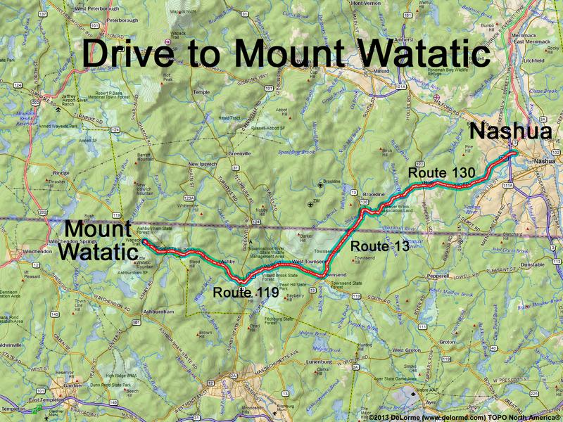
30 miles 1 hour
Park at trailhead parking lot
(off Route 119 in MA):
N 42 41.806
W 71 54.274
Google map: Mountains in Massachusetts
Roads (from Nashua NH):
- Route 130 west
- Route 13 south (4 miles) into MA
- Route 119 west (11 miles)
If a traverse, spot 2nd car at Binney Hill Road (in NH)
Binney Hill Road may be partially closed in winter
