 Wantastiquet Mountain
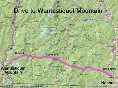
65 miles 1 3/4 hours
Park at Madame Sherri Forest
parking lot on Gulf Road:
N 42 51.883
W 72 31.068
Google map: Mountains in Southern NH
Roads (from Nashua NH):
- Route 101 west to Keene, NH
- Route 10 west (0.5 miles)
- Route 9 west (9.0 miles)
- Route 63 south (1.6 miles)
- Stage Road west (0.2 miles)
- Castle Hill Road southwest (0.9 miles)
- Gulf Road southwest (1.7 miles)