 Shrewsbury Peak
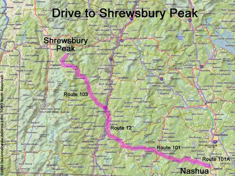
120 miles 3 hours
Park at roadside near the gate:
N 43 33.315
W 72 48.255
Google map: Southern Vermont
Roads (from Nashua NH):
- Route 101A northwest
- Route 101 west (39 miles)
- Route 12 north (22 miles)
- Arch Bridge west (to cross the
Connecticut River into Vermont)
- Rockingham Street (becomes Route 5)
north (3.0 miles)
- Route 103 northwest (36 miles)
- Town Hill Road north (1.8 miles)
- Lincoln Hill Road (becomes Northam Road and
then CCC Road) northeast (5.6 miles)
CCC Road may be closed in winter
Access from the east (via Shrewsbury Road
and Old CCC Road) is not possible as of August
2012 because this road is closed and gated
