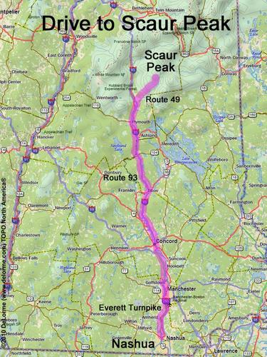
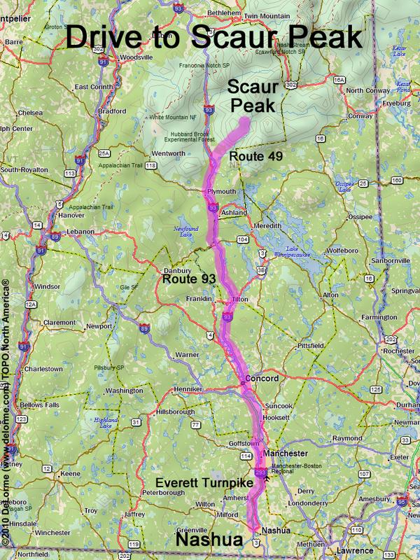
Scaur Peak
Location:
Southeast of the Kancamagus Highway
Near the town of Waterville Valley, NH
Driving (one way from Nashua, NH):
Distance: 100 miles
Time: 2 hours
Parking: at trailhead parking lot
Roads:
- Everett Turnpike north
- Route 93 north to Exit 28
- Route 49 east
Hiking (round trip):
Distance: 11 miles
Time: 7 hours
Trail: Livermore Road/Trail, Scaur Ridge Trail and bushwhack
Trail Guide: AMC White Mountain Guide
Topo Map: Mount Tripyramid NH 24k USGS quadrangle
Summit:
Forested summit with minimal view
Height: 3605 feet
Winter Accessibility:
Available year round
Back to: Scaur Peak photos
or NH Mountain Hiking