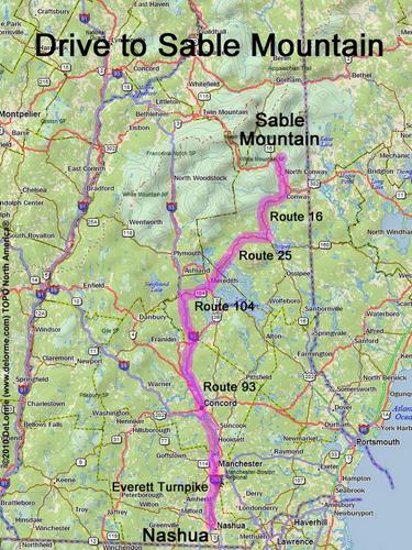
 Sable Mountain
130 miles 2 1/2 hours
Park at trailhead parking area:
N 44 10.785
W 71 05.066
Google map: NH 100 Highest
Roads (from Nashua NH):
- Everett Turnpike north
- Route 93 north to Exit 23
- Route 104 east (8.3 miles)
- Route 3 north (0.9 miles)
- Route 25 east (23 miles)
- Route 16 northeast (25 miles)
- Town Hall Road / Slippery Brook Road (7.3 miles) to gate
Access road may be closed in winter
(or due to recurring storm damage)