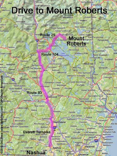
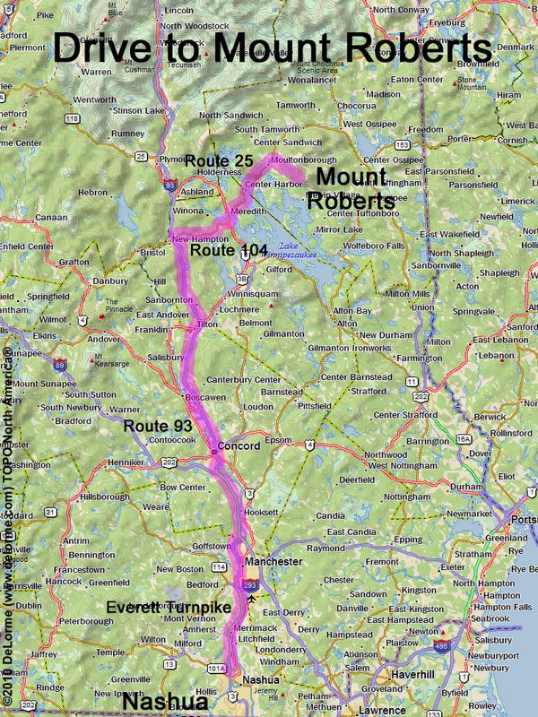
directions to Mount Roberts

Location:

Northeast of Lake Winnipesaukee
East of the town of Center Harbor, NH.

Driving (one way from Nashua, NH):

Distance: 85 miles
Time: 1 hour 50 minutes
Parking: at road-end parking lot by the gate house for Castle in the Clouds
If you use a car GPS, here are the road-end parking lot coordinates (in degrees and minutes):
    N 43 43.896
   W 71 19.514
Roads:
 - Everett Turnpike north
 - Route 93 north to Exit 23
 - Route 104 east
 - Route 3 north
 - Route 25 northeast through Moultonborough
 - Route 109 southeast (for 2.2 miles)
 - Route 171 southeast (for 0.5 miles)
 - Ossipee Park Road (for about 1.2 miles)

Hiking (round trip):

Distance: 5 miles
Time: 3 hours
Trail: Mt. Roberts Trail (beware poison ivy at trail start)
Trail Guide: AMC Southern NH Trailguide
Trail Map: Hiking Trails of the Castle in the Clouds Conservation Area published by Lakes Region Conservation Trust
GPS Track: Mount Roberts GPS Track

Hiking (one way, up to the summit):

Distance: 2.5 miles
Vertical: 1300 feet
Time: 1 hour 50 minutes

Summit:

Wooded summit with directional view, plus ledge views along the trail
Height: 2582 feet

Winter Accessibility:

Available year round


Back to: Mount Roberts photos
or NH Mountain Hiking