South Pack Monadnock Mountain
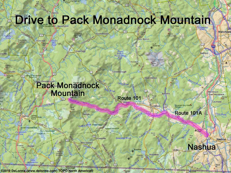
30 miles 45 minutes Park at Miller State Park (fee in season): N 42 50.995 W 71 53.235
LARGE MAP
Google map: Mountains in Southern NH
Roads (from Nashua NH): - Route 101A northwest - Route 101 west (16 miles)
Hiking
 South Pack Monadnock Mountain
