 North Pack Monadnock Mountain
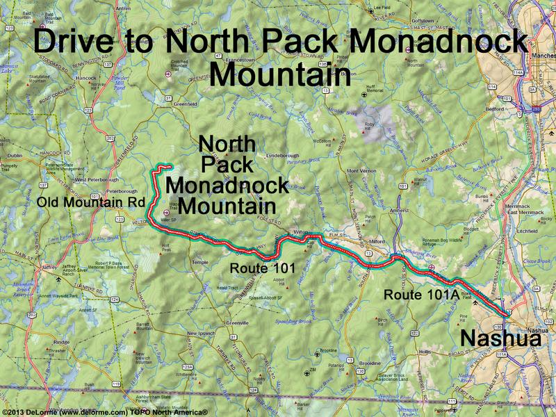
30 miles 1 hour
Park at Wapack Trail parking area:
N 42 54.016
W 71 52.495
Google map: Mountains in Southern NH
Roads (from Nashua NH):
- Route 101A west
- Route 101 west (16 miles) to just past
Miller State Park at the height of land
- Old Mountain Road / East Mountain Road
north (3.4 miles)
- Sand Hill Road northeast (0.8 miles)
- Mountain Road east (0.4)
Parking for Ted's Trail is farther east:
N 42 54.467
W 71 51.067
