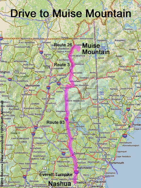
Muise Mtn.
Location:
Way north in NH, within Nash Stream Forest
Southeast of the town of Colebrook, NH
Driving (one way from Nashua, NH):
Distance: 180 miles
Time: 3 1/2 hours
Parking: at roadside
Roads:
- Everett Turnpike north
- Route 93 north to Exit 35
- Route 3 north
- Route 26 east
- Bungy Road
Hiking (round trip):
Distance: 10 miles
Time: 9 hours
Trail: bushwhack
Trail Guide: none
Topo Map: Blue Mountain NH 24k USGS quadrangle
Summit:
Forested summit with no view
Height: 3615 feet
Winter Accessibility:
The winter route is described here.
The summer route (from Nash Stream Road and a section of the Cohos Trail)
is easier.
Back to: Muise Mtn. photos
or NH Mountain Hiking