 < back
Moxie
next >
< back
Moxie
next >
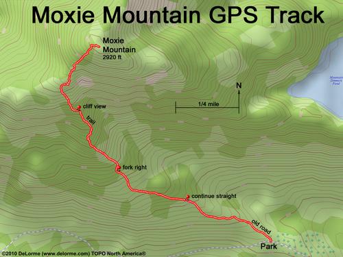
| Here is a GPS track of my hike up Moxie. At the mid-path cairn, continue straight; at the upper-path cairn, fork right; and at path end, continue into the woods on an unmarked trail. The roundtrip hike is 3 miles, going up 1500 feet and takes 3 hours. |