 Moore State Park
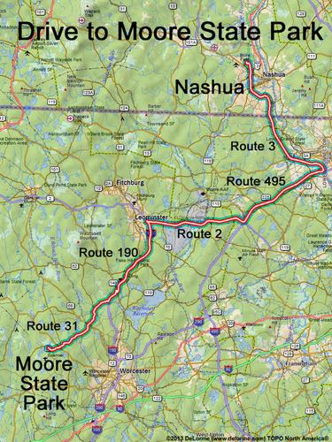
65 miles 1 1/4 hours
Park at trailhead parking lot:
N 42 18.617
W 71 57.308
Google map: Nature Walks in Northeastern MA
Google map: Mountains in Massachusetts
Roads (from Nashua NH):
- Route 3 south to Exit 81B in Massachusetts
- Route 495 south (11 miles) to Exit 78B
- Route 2 west (11 miles) to Exit 22
- Route 190 south (10 miles) to Exit 9
- Route 140 north (0.2 miles)
- Raymond Huntington Highway southwest (1.7 miles)
- Manning Street southwest (2.0 miles)
- Route 31 southwest (7.6 miles)
- Mill Street northwest (0.2 miles)