 < back
Misery
next >
< back
Misery
next >
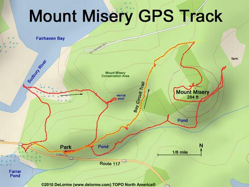
| Here is my GPS track. I first do a loop starting on the Bay Circuit Trail (highlighted in yellow) to Mount Misery, then a second loop to see Farrar Pond, Sudbury River and (by chance) the vernal pool. Mount Misery is supposedly named after a pair of oxen who got stuck on top and perished. |