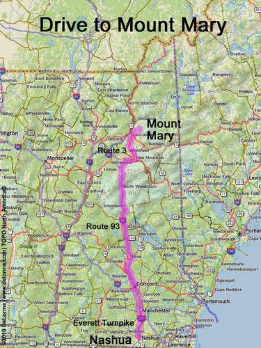
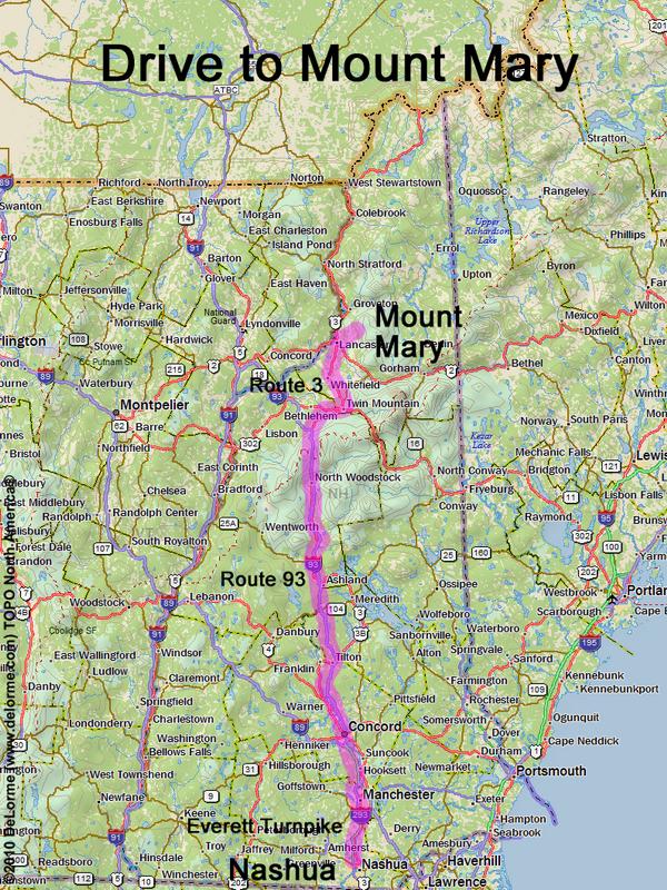
 Mount Mary
140 miles 2 1/2 hours
Park at roadside:
N 44 31.089
W 71 28.943
Google map: NH 100 Highest
Roads (from Nashua NH):
- Everett Turnpike north
- Route 93 north to Exit 35
- Route 3 north (27 miles) to Lancaster, NH
- Mechanic Street / Middle Street / North Road
east (1.9 miles)
- Grange Road northeast (2.1 miles)
- Lost Nation Road northeast (1.9 miles)