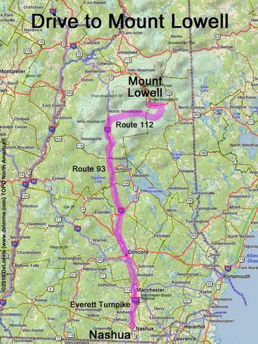
 Mount Lowell
140 miles 2 1/2 hours
Park at trailhead parking lot
Here is where Sawyer River Road
leaves west from Route 302:
N 44 05.200
W 71 21.107
Google map: NH 100 Highest
Roads (from Nashua NH):
- Everett Turnpike north
- Route 93 north to Exit 32
- Route 112 east (23 miles)
- Bear Notch Road North (8.9 miles) to Bartlett, NH
- Route 302 northwest (4.0 miles)
- Sawyer River Road west
Bear Notch Road and Sawyer River Road may be closed in winter