 < back
Watatic
next >
< back
Watatic
next >
|
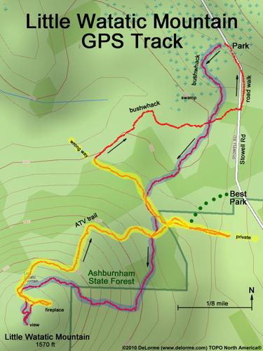
Here is our GPS track.
We park at what looks like the start of a woods road, but it
isn't and we wind up bushwhacking to the summit (blue highlight).
Coming down we follow an ATV trail (yellow highlight), but it
ends on private property in one direction (east) and goes the wrong way
in the other direction (west), so we wind up bushwhacking again.
My recommendation for hiking this mountain is to park at the snowplow turn-around ("Best Park"), bushwhack over to the ATV trail (green dots) and then follow the ATV trail (yellow highlight) to the summit. |