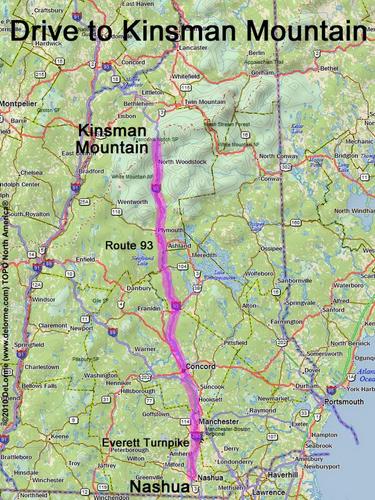
directions to Kinsman Mountain

Location:

On the west side of Franconia Notch
Near the town of Franconia, NH

Driving (one way from Nashua, NH):

Distance: 110 miles
Time: 1 hour 55 minutes
Parking: at Lafayette Campground parking lot
Roads:
 - Everett Turnpike north
 - Route 93 north (turn around at Exit 34B)

Hiking (round trip):

Distance: 8 miles
Time: 6 hours
Trail: Lonesome Lake Trail, Fishin' Jimmy Trail and Kinsman Ridge Trail
Trail Guide: AMC White Mountain Guide

Hiking (one way, up to the summit):

Distance: 4.1 miles
Vertical: 2700 feet
Time: 3 hours 20 minutes

Summit:

Forrested summit with directional view from ledge
Height: 4293 feet
Wikipedia description: Kinsman Mountain

Winter Accessibility:

Available year round

Alternate Approach:

Via the west side, take the Mount Kinsman Trail from Route 116
The trailhead parking lot coordinates (deg & min) are: N 44 09.907, W 71 45.956
The hike in (to North Kinsman) is 4.1 miles, going up 3300 feet, and takes 3 hours and 45 minutes
The roundtrip hike (including South Kinsman) is 10 miles, going up 4000 feet, and takes 7 1/2 hours
GPS Track: Kinsman Mountain GPS Track


Back to: Kinsman Mountain photos
or NH Mountain Hiking