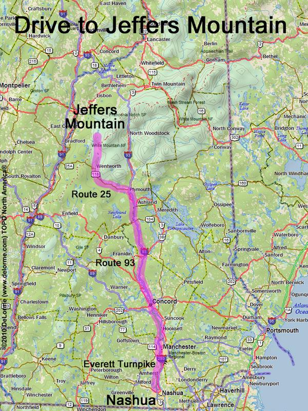
directions to Jeffers Mountain
Location:
West of Mount Moosilauke
North of the town of Glencliff, NH
Driving (one way from Nashua, NH):
Distance: 105 miles
Time: 2 hours and 15 minutes
Parking: at roadside
If you use a car GPS, here are the roadside parking coordinates (in degrees and minutes):
N 44 02.116
W 71 53.519
Roads:
- Everett Turnpike north
- Route 93 north to Exit 26
- Route 25 west
- Sanitorium Road north
- Long Pond Road (previously called North-South Road) north (for 3.8 miles)
Hiking (round trip):
Distance: 3 miles
Time: 5 hours
Vertical: 800 feet
Trail: bushwhack
Trail Guide: none
Topo Map: East Haverhill NH 24k USGS quadrangle
GPS Track: Jeffers Mountain Rectangle GPS Track
Summit:
Viewless forested summit, but spectacular view from nearby "The Hogback" ridge
Height: 2994 feet
Winter Accessibility:
Access road (Long Pond Road) may be closed in winter, increasing hike length
Back to: Jeffers Mountain photos
or NH Mountain Hiking