 Mount Greylock
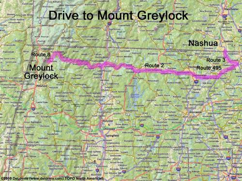
135 miles 3 hours
Park at end of road:
N 42 38.010
W 73 08.429
Google map: Mountains in Massachusetts
Roads (from Nashua NH):
- Route 3 south to Exit 81B in Massachusetts
- Route 495 west (11 miles) to Exit 78B
- Route 2 west (36 miles) to North Adams, MA
- Route 8 south (4.5 miles)
- Friend Street southwest (1.1 miles)
- West Road southwest (0.4 miles)
- Gould Road northwest (0.4 miles)
- Thiel Road northwest (0.5 miles)