 Gore Mountain
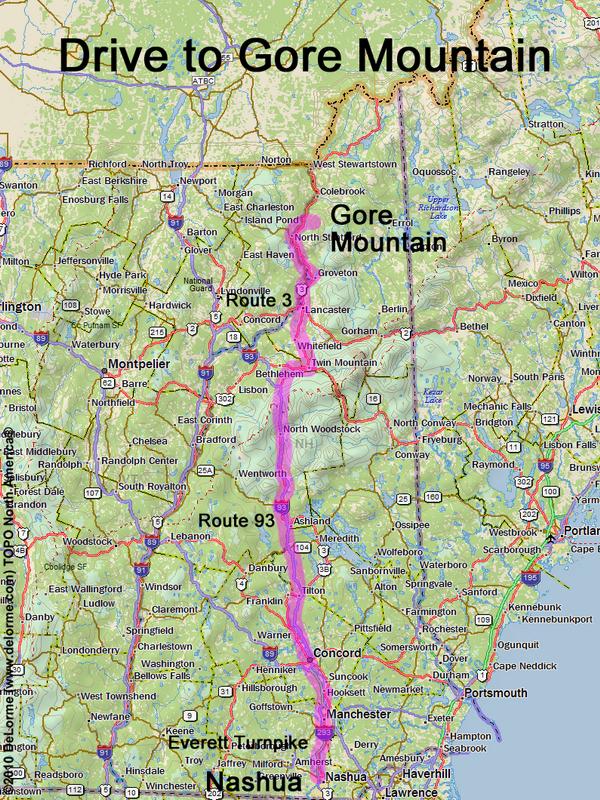
160 miles 3 1/4 hours
Park at roadside
Here is where Meridan Hill Road
leaves east off Route 3:
N 44 46.765
W 71 34.986
Google map: NH 100 Highest
Roads (from Nashua NH):
- Everett Turnpike north
- Route 93 north to Exit 35
- Route 3 north (to Tinkerville [see note below];
3.2 miles north of Route 105)
- Meriden Hill Road (to Meriden Hill;
1.6 miles from Route 3)
- Brown Road (southeast for 1.5 miles)
- lumber road (go straight where Brown Road
turns right downhill; 0.7 miles to gate)
Access roads may be closed in winter
The DeLorme New Hampshire Atlas and Gazetteer
shows two towns in New Hampshire named "Tinkerville":
- one in Stratford (p46) -- this is the one noted in the directions above
- another in Lyman (p42) -- this is NOT the right one!
