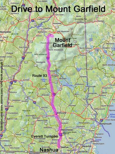
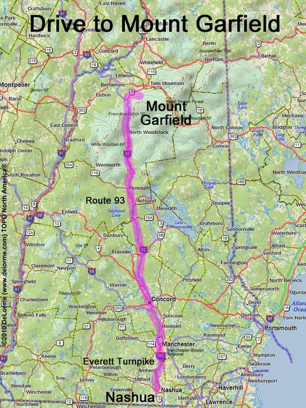
Mt. Garfield

Location:

Northeast of Franconia Notch
East of the town of Franconia, NH

Driving (one way from Nashua, NH):

Distance: 115 miles
Time: 2 hours 0 minutes
Parking: at trailhead parking lot
Roads:
 - Everett Turnpike north
 - Route 93 north to Exit 35
 - Route 3 north
 - Gale River Loop Road

Hiking (round trip):

Distance: 10 miles
Time: 7 hours
Trail: Garfield Trail
Trail Guide: AMC White Mountain Guide

Hiking (one way, up to the summit):

Distance: 5.0 miles
Vertical: 3000 feet
Time: 4 hours 0 minutes

Summit:

Rock summit with panoramic view
Height: 4500 feet

Winter Accessibility:

Access road (Gale River Loop Road) may be closed in winter, increasing hike length


Back to: Mt. Garfield photos
or NH Mountain Hiking