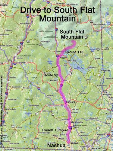
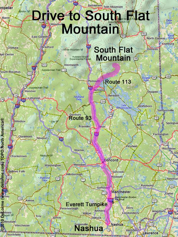
directions to South Flat Mountain

Location:

In the Sandwich Range Wilderness, east of Sandwich Dome
North of the town of Sandwich, NH
South of Flat Mountain Pond

Driving (one way from Nashua, NH):

Distance: 95 miles
Time: 2 hours 5 minutes
Parking: at trailhead parking lot
Roads:
 - Everett Turnpike north
 - Route 93 north to Exit 24
 - Route 3 east
 - Route 113 northeast
 - Route 113A north
 - Whiteface Intervale Road
 - Bennett Street
 - Bennett Street Loop Road

Hiking (round trip):

Distance: 3 miles
Time: 4 hours
Trails: bushwhack
Trail Guide: none
Topo Map: Mount Tripyramid NH 24k USGS quadrangle

Summit:

Wooded summit without a view
Height: 2940 feet

Route Info:

We had good luck bushwhacking to this summit from the south.
From the access road we went slightly west of due north up to the ridge, then followed
the north edge of the ridge up to the summit. Mostly open woods the whole way.
Coming down we went due south -- a little steep but otherwise not too bad.

Winter Accessibility:

The access road (Bennett Street) may be closed in winter, lengthening the hike


Back to: South Flat Mountain photos
or NH Mountain Hiking