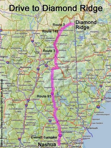
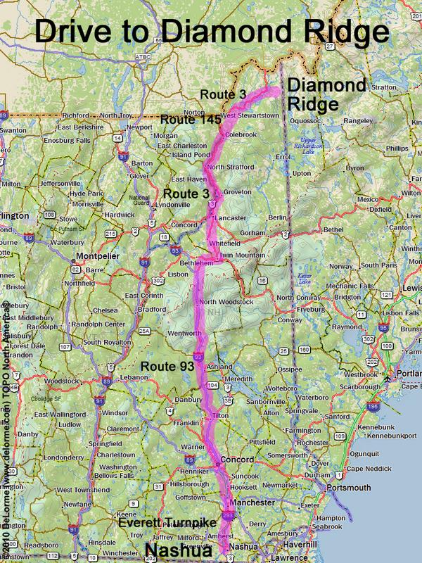
 Diamond Ridge
205 miles 4 1/4 hours
Park at road end
Here is where Magalloway Road
leaves south from Route 3:
N 45 07.777
W 71 13.393
Google map: NH 3000-Footers
Roads (from Nashua NH):
- Everett Turnpike north
- Route 93 north to Exit 35
- Route 3 north (63 miles)
- Route 145 north (13 miles)
- Route 3 north (12 miles)
- Magalloway Road southeast
- unnamed spur lumber road
Magalloway Road may be closed in winter