 < back
Deer Leap
next >
< back
Deer Leap
next >
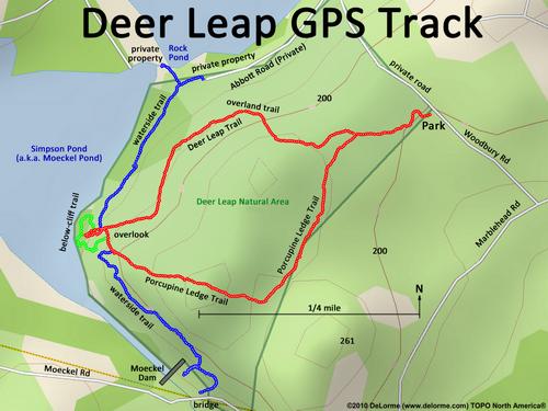
| Here is my GPS-track map. The overland trail (red) is the normal way to get from the parking lot to the overlook. The waterside trail (blue) is another option; and the below-cliff trail (green) gets you to the bottom of the cliff for rock climbing. |