 < back
Dead
next >
< back
Dead
next >
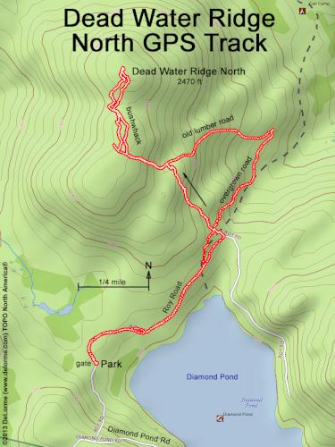
| Here is our GPS track. We walk Roy Road, then bushwhack uphill. On the way down we opt to follow an old lumber road (even though it goes in the wrong direction), hoping for easier hiking. We luck out, finding an overgrown road to follow back to Roy Road and our car. Even though most of this hike is on roads, walking 3 mph, the bushwhack slows us down to a whole-hike average of barely over 1 mph. |