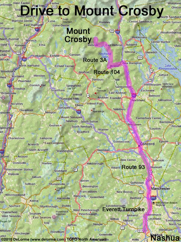
directions to Mount Crosby

Location:

Northwest of Newfound Lake, NH
West of the town of Plymouth, NH

Driving (one way from Nashua, NH):

Distance: 85 miles
Time: 1 hour 50 minutes
Parking: at small trailhead parking lot
If you use a car GPS, here are the parking lot coordinates (in degrees and minutes):
    N 43 43.748
   W 71 50.499
Roads:
 - Everett Turnpike north
 - Route 93 north to Exit 23
 - Route 104 west (for 5.8 miles, to Bristol)
 - Route 3A north (for 8.7 miles, to the top of Newfound Lake)
 - North Shore Road west (for 2.4 miles)
 - Groton Road west (for 1.6 miles)
 - North Groton Road north (for 2.0 miles)
 - unknown dirt road northeast (for 0.1 miles)

Hiking (round trip):

Distance: 4 miles
Time: 3 hours
Vertical: 1400 feet
Trails: unlabeled lumber roads and foot paths
Online Trail Guide: FranklinSites
GPS Track: Mount Crosby GPS Track

Summit:

Open ledge with directional view
Height: 2230 feet

Winter Accessibility:

Access road may be closed in winter, increasing hike length and making parking problematic.
Back to: Mount Crosby       or: NH Mountain Hiking