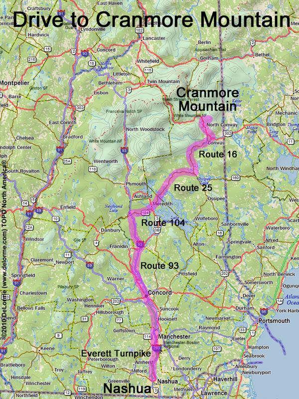
directions to Cranmore Mountain
Location:
In northeastern NH, near the Maine border
In the town of North Conway, NH
Driving (one way from Nashua, NH):
Distance: 120 miles
Time: 2 hours 40 minutes
Parking: at roadside
Roads:
- Everett Turnpike north
- Route 93 north to Exit 23
- Route 104 east
- Route 3 north
- Route 25 east
- Route 16 north
- Hurricane Mountain Road east
Hiking (round trip):
Distance: 3 miles
Time: 3 hours
Trails: lumber roads, bike/hike trails, and bushwhack
Trail Guide: none
Topo Map: North Conway East NH 24k USGS quadrangle
Hiking (one way, up to the summit):
Distance: 1 1/2 miles
Vertical: 1000 feet
Time: 2 hours
Summit:
Open summit with ski lift/trails and directional views
Height: 1667 feet
Winter Accessibility:
Available year round.
Back to: Cranmore Mountain photos
or NH Mountain Hiking