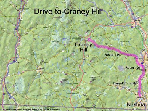
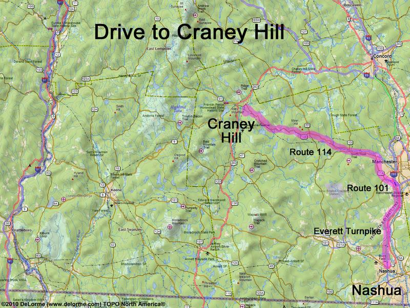
directions to Craney Hill

Location:

In southern NH, near Pat's Peak Ski Area
South of the town of Henniker, NH
This is one of the Hikes to Towers

Driving (one way from Nashua, NH):

Distance: 45 miles
Time: 1 hour 5 minutes
Parking: at roadside
If you use a car GPS, here are the roadside coordinates (in degrees and minutes):
    N 43 08.932
   W 71 48.109
Roads:
 - Everett Turnpke north
 - Route 101 west (for 2.1 miles)
 - Route 114 northwest (for 23.7 miles)
 - Flanders Road southwest (for 0.9 miles)
 - Craney Hill Road south (for 1.1 miles)

Hiking (round trip):

Distance: 1 mile
Time: 1/2 hour
Vertical: 200 feet
Trail: old tower road
Trail Guide: none
GPS Track: GPS Track to Craney Hill

Summit:

The summit fire tower is usually closed, therefore no view; but there are directional views from nearby Pat's Peak ski area.
(Note: the tower may be open for fall foliage season, in which case the dates may be posted on the Town of Heniker, NH website.)
Height: 1402 feet

Winter Accessibility:

Available year round


Back to: Craney Hill photos
or NH Mountain Hiking