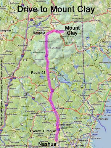
Mt. Clay
Location:
North of Mt. Washington
Near the town of Randolph, NH
Driving (one way from Nashua, NH):
Distance: 130 miles
Time: 2 hours 30 minutes
Parking: at trailhead parking lot
Roads:
- Everett Turnpike north
- Route 93 north to Exit 35
- Route 3 north
- Route 302 east
- Cog Railway Base Road
Hiking (round trip):
Distance: 10 miles
Time: 7 hours
Trails: Jewell Trail and Clay Loop
Trail Guide: AMC White Mountain Guide
Hiking (one way, up to the summit):
Distance: 4.8 miles
Vertical: 3800 feet
Time: 4 hours 15 minutes
Summit:
Above-treeline dome with panoramic view
Height: 5531 feet
Winter Accessibility:
Available year round
Back to: Mt. Clay photos
or NH Mountain Hiking