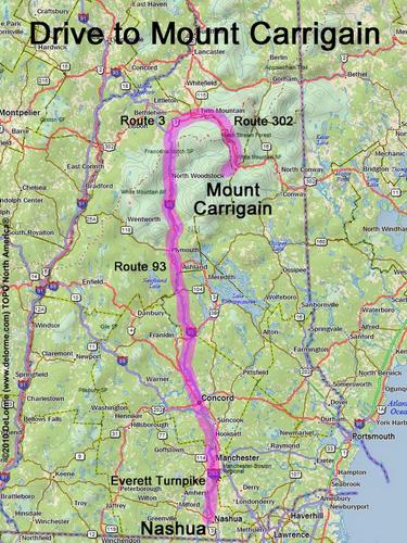
directions to Mount Carrigain

Location:

Southwest of Crawford Notch
West of the town of Bartlett, NH
This is one of the Hikes to Towers

Driving (one way from Nashua, NH):

Distance: 140 miles
Time: 2 hours 40 minutes
Parking: at trailhead parking lot
Roads:
 - Everett Turnpike north
 - Route 93 north Exit 35
 - Route 3 north
 - Route 302 east
 - Sawyer River Road

Hiking (round trip):

Distance: 10 miles
Time: 7 hours
Trail: Signal Ridge Trail
Trail Guide: AMC White Mountain Guide

Hiking (one way, up to the summit):

Distance: 5.0 miles
Vertical: 3300 feet
Time: 4 hours 10 minutes

Summit:

Panoramic view from summit tower
Height: 4700 feet
Wikipedia description: Mount Carrigain

Winter Accessibility:

Access road (Sawyer River Road) may be closed in winter, increasing hike length


Back to: Mount Carrigain photos
or NH Mountain Hiking