 < back
Camels Hump
next >
< back
Camels Hump
next >
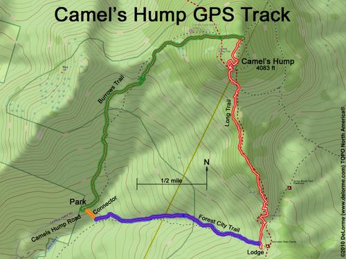
| Here is our GPS track: going up the Burrows Trail (green), across the Long Trail (red), down the Forest City Trail (blue) and back to our car via the Connector trail (orange). A distance of 6 miles, going up 2300 feet and taking 6 hours. |