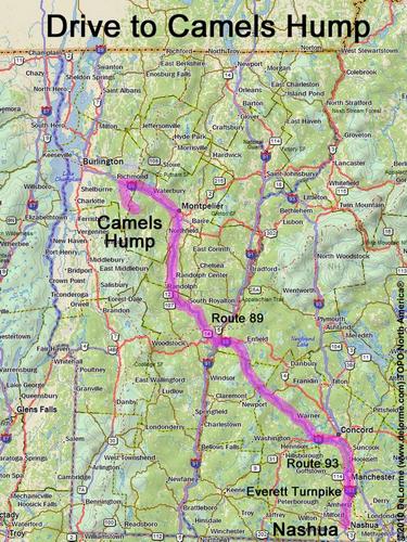
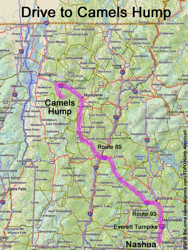
directions to Camels Hump

Location:

Northwest Vermont, east of Burlington
Near the town of Huntington, VT

Driving (one way from Nashua, NH):

Distance: 180 miles
Time: 3 hours 30 minutes
Parking: at Burrows trailhead parking lot
If you use a car GPS, here are the parking lot coordinates (in degrees and minutes):
    N 44 18.294
   W 72 54.473
Roads:
 - Everett Turnpike north
 - Route 93 north
 - Route 89 west (to Exit 11 in Vermont)
 - Route 2 east (for 1.7 miles)
 - Huntington St/Main Rd south (for 8.8 miles to Huntington Center)
 - Camels Hump Rd east (for 3.5 miles, to end)

Hiking (round trip loop hike):

Distance: 6 miles
Time: 6 hours
Trails: Burrows Trail, Long Trail, Forest City Trail and Connector trail
Trail Guide: Hiker's Guide to the Mountains of Vermont
Trail Map: Camel's Hump GPS Track

Summit:

Rocky summit with panoramic view
Height: 4083 feet
Wikipedia description: Camel's Hump (Vermont)

Hiking (one way, up to the summit):

Distance: 2.5 miles
Vertical: 2300 feet
Time: 2.5 hours

Winter Accessibility:

Trails may be closed in "mud season" (April 15 - May 30)
The access road (Camels Hump Road) may be closed in winter, increasing hike length.
Back to: Camels Hump       or: NH Mountain Hiking