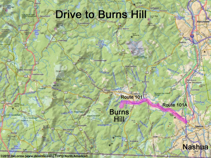
directions to Burns Hill

Location:

Southern NH, west of Nashua
In the town of Milford, NH

Driving (one way from Nashua, NH):

Distance: 15 miles
Time: 35 minutes
Parking: at the trailhead parking lot
If you use a car GPS, here are the trailhead parking lot coordinates (in degrees and minutes):
    N 42 48.512
   W 71 41.017
Roads:
 - Route 101A northwest
 - Route 101 west (for 1.3 miles)
 - Route 13 south (for 0.2 miles)
 - Armory Road west (for 1.0 mile)
 - Osgood Road southwest (for 1.2 miles)
 - Mullen Road west (for 0.2 miles)

Hiking (round trip):

Distance: 1 mile
Time: 3/4 hour
Vertical: 250 feet
Trail: unnamed
On-line Trail Guide: Hitchiner Town Forest
GPS Track: Burns Hill GPS Track

Summit:

Open summit with a limited view
Height: 720 feet

Winter Accessibility:

Available year round
Back to: Burns Hill       or: NH Mountain Hiking