 Boundary Peak
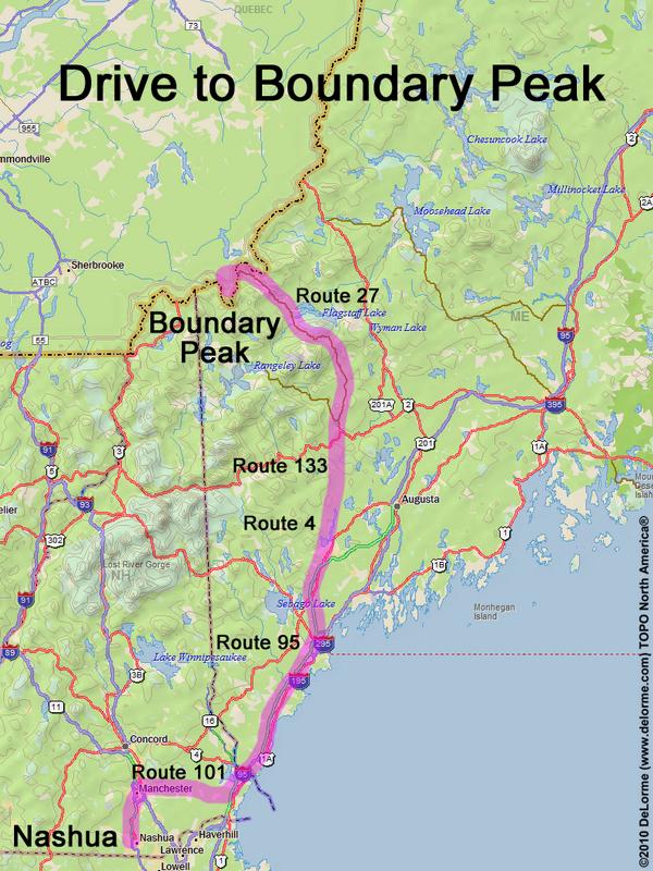
280 miles 6 hours
Park at gravel pit
Here is where Route 27 reaches
the Canadian border:
N 45 22.721
W 70 48.474
Google map: New England 100 Highest - Maine
Roads (from Nashua NH):
- Route 101 east
- Route 95 north (85 miles) to Exit 75 in Maine
- Route 4 north (33 miles) to Livermore Falls, ME
- Route 133 north (11 miles)
- Route 2 northeast (3 miles) to Farmington, ME
- Route 27 north (about 73 miles) to Canada
- Route 161 / Route 212 west
- dirt road south (fee: $5 Canadian)
Access road may be closed in winter
