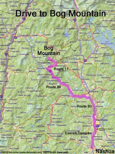
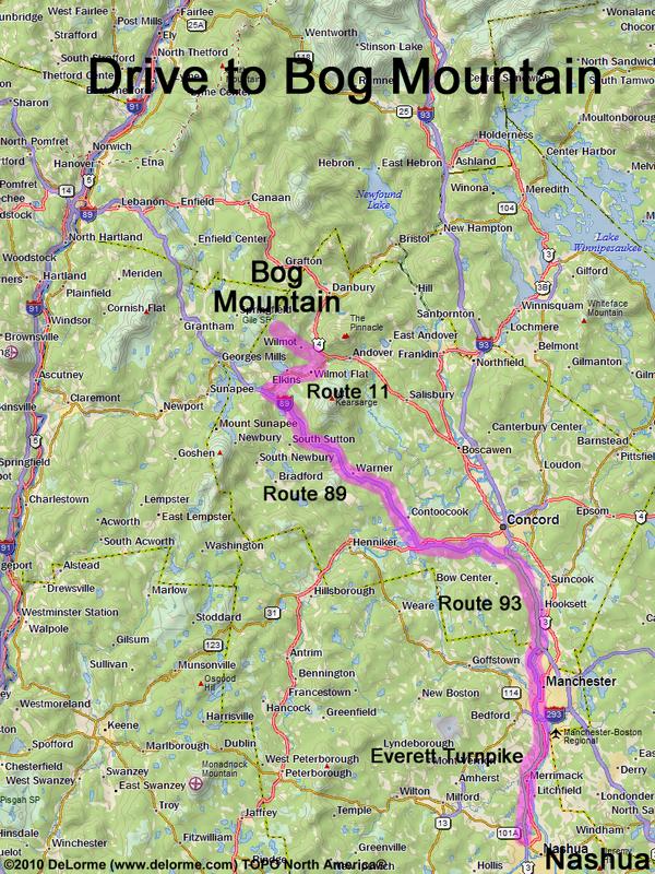
directions to Bog Mountain

Location:

Northeast of Lake Sunapee
North of the town of Wilmot, NH

Driving (one way from Nashua, NH):

Distance: 75 miles
Time: 1 hour 30 minutes
Parking: at roadside
If you use a car GPS, here are the roadside parking coordinates (in degrees and minutes):
    N 43 28.337
   W 71 56.540
Roads:
 - Everett Turnpike north
 - Route 93 north
 - Route 89 northwest to Exit 11
 - Route 11 east (for 6.8 miles)
 - Route 4A north (for 4.8 miles)
 - Stearns Hill Road (for 0.7 miles)

Hiking (round trip):

Distance: 2 miles
Time: 1 1/2 hours
Trail: Bog Mountain Trail
Trail Guide: AMC Southern New Hampshire Trail Guide
Trail Map: Trail 7 of the SRKG Trail Guide
GPS Track: Bog Mountain GPS Track

Hiking (one way, up to the summit):

Distance: 1 mile
Vertical: 700 feet
Time: 45 minutes

Summit:

Directional views from summit ledges
Height: 1787 feet

Winter Accessibility:

The access road (Stearns Hill Road) may not have parking space in winter, extending the hike length.


Back to: Bog Mountain photos
or NH Mountain Hiking