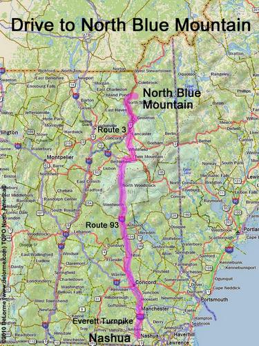
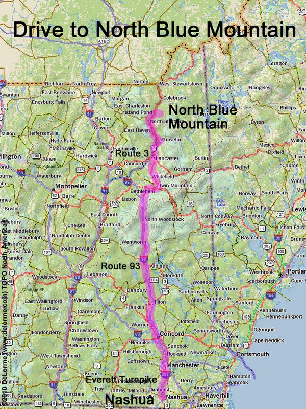
directions to North Blue Mountain
Location:
North of Nash Stream Forest
South of the town of Colebrook, NH
Driving (one way from Nashua, NH):
Distance: 170 miles
Time: 3 hours 15 minutes
Parking: at roadside near gate
Roads:
- Everett Turnpike north
- Route 93 north to Exit 35
- Route 3 north (19.4 miles past the junction with Route 110 in Groveton)
- Washborn Road east (for 1.4 miles, to gate)
Hiking (round trip):
Distance: 7 miles
Time: 5 hours
Trail: lumber-road, ATV track and bushwhack
- walk the extension of Washborn Road for about 3 miles, all the way to Cleveland Notch
- hike the ATV track northwest for about 1/3 mile
- bushwhack for about 1/6 mile to the summit
Trail Guide: none
Topo Maps: Blue Mountain and Tinkerville NH 24k USGS quadrangles
Summit:
Wooded viewless summit
Height: 3190 feet
Winter Accessibility:
The access road (Washburn Road) may be closed in winter, adding to the hike length
Back to: North Blue Mountain
or: NH Mountain Hiking