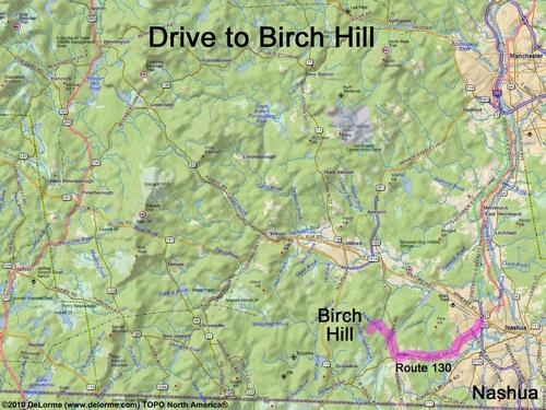
 Birch Hill
12 miles 25 minutes
Park at roadside:
N 42 45.885
W 71 37.345
Or, to start hiking from Monson Village parking lot:
N 42 47.031
W 71 37.477
Google map: Mountains in Southern NH
Roads (from Nashua NH):
- Route 130 west to Hollis, NH
- Route 122 north (0.8 miles)
- Federal Hill Road northwest (1.9 miles)
- Hayden Road southwest (0.7 miles)
Or, to start hikiing from Monson Village parking lot:
- skip Hayden Road and instead stay on
Federal Hill Road for another mile