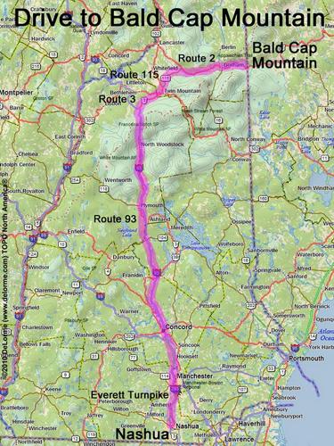
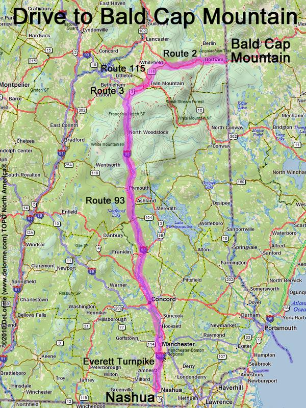
 Bald Cap Mountain
150 miles 3 hours
Park at roadside:
N 44 26.036
W 71 04.178
Google map: NH 3000-Footers
Roads (from Nashua NH):
- Everett Turnpike north
- Route 93 north to Exit 35
- Route 3 north (12 miles)
- Route 115 north (9.6 miles)
- Route 2 east (19 miles) to Shelburne, NH
- Meadow Road north (0.9 miles)
- North Road west (150 ft)
- Millbrook Road north (1.7 miles)
- Austin Brook Trail north (0.6 miles;
yes, this segment is a drivable road)
The access road may be closed in winter