 < back
Bald
next >
< back
Bald
next >
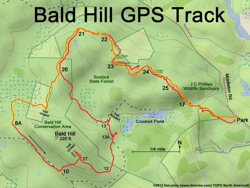
| Here is my GPS track. I follow the Bay Circuit Trail (highlighted in yellow) out, then other unnamed trails back. The numbers are trail-junction markers. I want to take the shortcut trail past Crooked Pond, but lacking waders (or a boat) I have to circle around the major beaver flooding and retrace my steps on the BCT. The true summit of Bald Hill is posted as an Animal Habitat and the trail is closed at both ends. GPS accuracy is poor today due to heavy overcast weather, causing some imaginary track squiggles. |