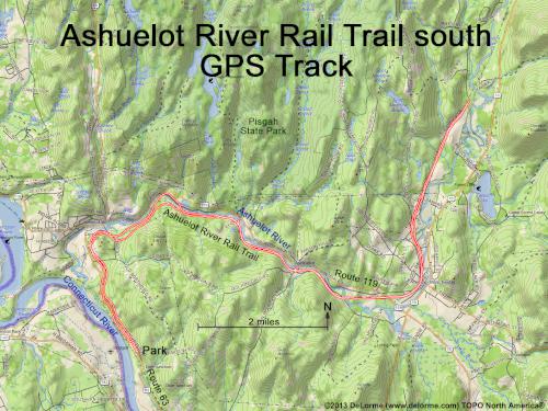
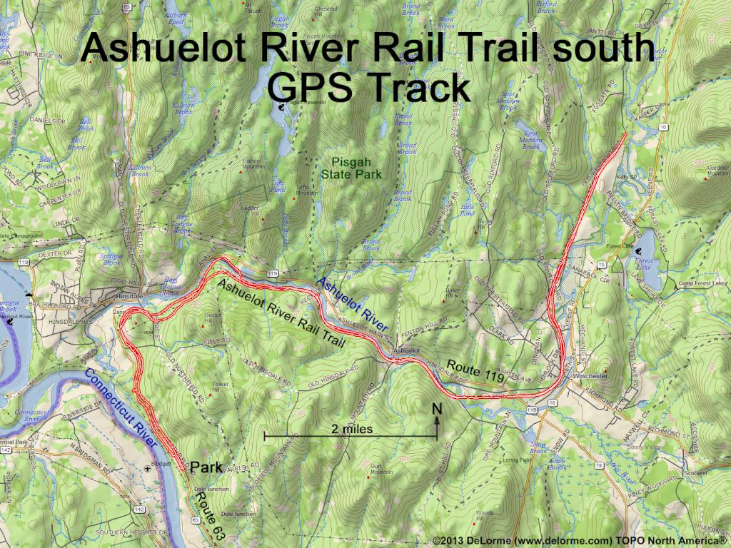
 Ashuelot River Rail Trail south
Ashuelot River Rail Trail south
Bike Ashuelot River Rail Trail south and back:
23 miles 400 feet up 4 hours (easy)
Hike List: Nature Walks
Guide: The Ashuelot Rail-Trail
Website: All Trails
Mostly flat terrain beside river, buildings and open land
Available year round, but set up for snowmobiling in winter
Dogs are allowed