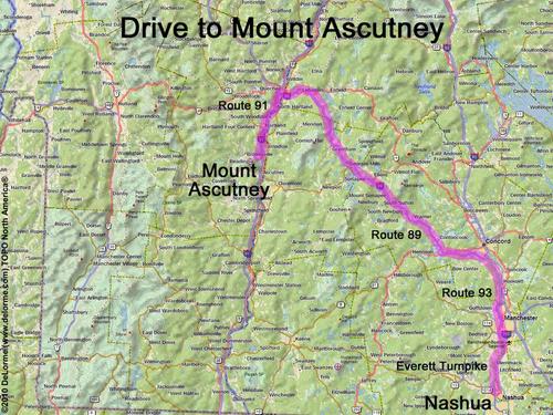
directions to Mount Ascutney
Location:
On the VT/NH border, south of Lebanon, NH
Near the town of Windsor, VT
Driving (one way from Nashua, NH):
Distance: 110 miles
Time: 2 hours
Parking: at trailhead parking lot
Roads:
- Everett Turnpike north
- Route 93 north
- Route 89 west (into Vermont)
- Route 91 south
- Route 131 west (to Wethersfield trailhead);
or Route 44 west (to Windsor trailhead)
Hiking (round trip):
Distance: 6 miles
Time: 4 hours
Vertical: 2500 feet
Trail: Wethersfield Trail (from the west) or Windsor Trail (from the east)
Trail Guides: GMC Day Hiker's Guide to Vermont
or Hiker's Guide to the Mountains of Vermont
Windsor Trail GPS Track: Mount Ascutney GPS Track
Summit:
Panoramic view from summit tower
Height: 3150 feet
Wikipedia description: Mount Ascutney
Winter Accessibility:
Available year round
Back to: Mount Ascutney photos
or NH Mountain Hiking