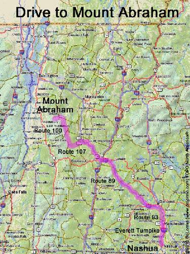
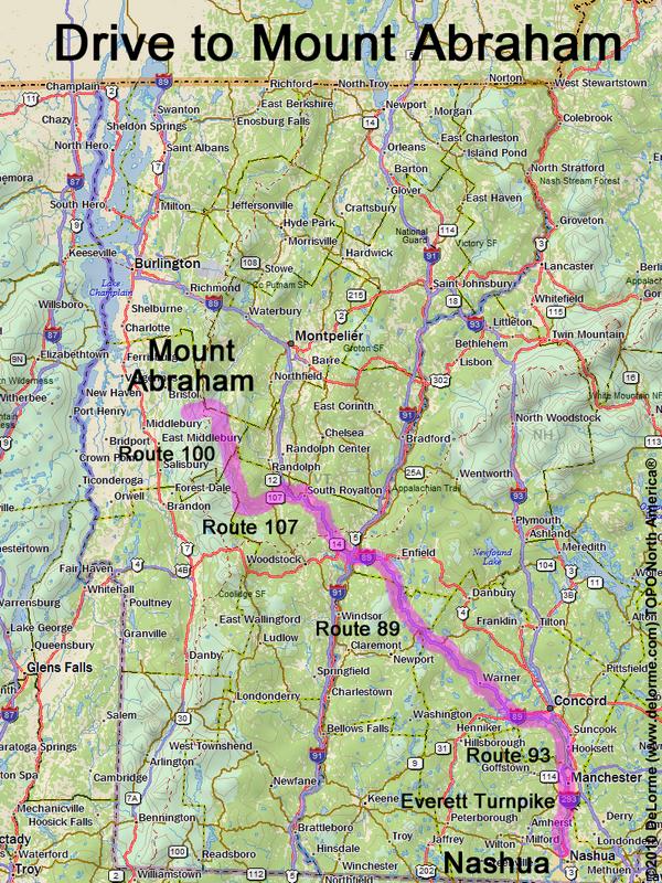
directions to Mount Abraham
Location:
Central Vermont, west of Montpelier
Near the town of Warren, VT
Driving (one way from Nashua, NH):
Distance: 150 miles
Time: 3 hours
Parking: at roadside
If you use a car GPS, here are the Lincoln Gap parking area coordinates (in degrees and minutes):
N 44 05.689
W 72 55.684
Roads:
- Everett Turnpike north
- Route 93 north
- Route 89 west
- Route 107 west
- Route 100 northwest
- Lincoln Gap Road west (to the height of land)
Hiking (round trip to just Abraham):
Distance: 5 miles
Time: 4 hours
Trail: Long Trail
Trail Guide: Hiker's Guide to the Mountains of Vermont
Hiking (traverse over both Abraham and Ellen):
Distance: 11 miles
Vertical: 2500 feet
Time: 7 hours
Trail Map: Abraham/Ellen GPS Track
Note: this requires a car spot at the Jerusalem Trailhead (on Jim Dwire Road)
If you use a car GPS, here are the Jerusalem Trailhead coordinates (in degrees and minutes):
N 44 10.600
W 72 58.102
Summit:
Bare summit with panoramic view
Height: 4006 feet
Wikipedia description: Mount Abraham (Vermont)
Wikipedia description: Mount Ellen (Vermont)
Winter Accessibility:
Trails may be closed in "mud season" (April 15 - May 30)
The access road (Lincoln Gap Road) may be closed in winter, requiring a different starting point.
Back to: Mount Abraham photos
or NH Mountain Hiking